Halsema Highway
Halsema Highway
The Halsema Highway links Baguio to Bontoc over 150 km through the Cordillera, at altitudes exceeding 2,200 meters. Practical guide to exploring it.
The Halsema Highway, also known as the Baguio–Bontoc Road or Mountain Trail, traverses the central Cordillera in the north of Luzon island. Spanning approximately 150 kilometers, it connects Baguio to Bontoc, crossing eight municipalities in Benguet and four towns in Mountain Province. Long considered the highest road in the Philippines, it remains an essential route to reach high-altitude villages and the rice terraces of the country's north.
Why drive the Halsema Highway
The Halsema offers direct access to the highlands of the Cordillera, at altitudes uncommon elsewhere in the Philippines. Along its length, you traverse terraced crops, pine forests, rural markets, and villages inhabited by Igorot communities. It's also the main route used by farmers transporting vegetables to Baguio, giving the road constant activity, particularly visible in the early morning.
Beyond the landscape, the journey connects major sites in northern Luzon such as Sagada and Bontoc, recognized for their natural and cultural heritage.
A road steeped in history
The highway bears the name of Eusebius Julius Halsema, an American engineer and mayor of Baguio from 1920 to 1937. Construction began in 1922 with assistance from local residents. Eight years later, the first route was completed in the form of a simple footpath.
The road was subsequently widened and improved in stages. Major paving works were carried out in 2011, transforming most of the route into an asphalt surface, though some sections remain rough. Over the decades, the Halsema has become the economic backbone of the Cordillera, linking highland communities to the rest of Luzon.
What to see along the way
The highest point at Atok
The road was long the highest in the country, with its highest point at 2,255 meters in the municipality of Atok. It was surpassed in 2019 by the Kiangan–Tinoc–Buguias road, which reaches 2,429 meters. The passage through Atok offers sweeping views across the Cordillera and houses several flower farms open to visitors.
Terraces and villages of Benguet
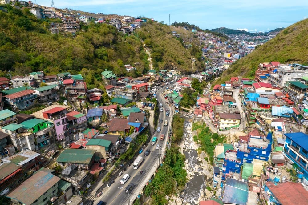
Between Baguio and the Mountain Province boundary, the road crosses terraced crops dedicated mainly to vegetables (cabbage, carrot, potato). Roadside markets allow you to observe this highland agricultural economy.
The Dantay junction: Sagada or Bontoc
Near the village of Dantay, the road divides. One branch leads to Bontoc, capital of Mountain Province, where the local museum documents Igorot culture. The other heads to Sagada, approximately 29 kilometers away, famous for its hanging coffins, caves, and hiking trails.
Practical advice
The Halsema is known for its tight curves, steep slopes, and changeable weather conditions. It ranked 9th in the March 2013 List25 ranking of the world's most dangerous roads and was featured in the Discovery World program Hot Roads – World's Most Dangerous Roads. Caution remains necessary, particularly on unimproved sections heading toward Sagada.
- Choose appropriate transport: a 4x4 is preferable, especially during the wet season.
- Check local weather before departure: in the mountains, conditions change rapidly.
- Pack essentials: warm clothing, water, snacks, and a first-aid kit.
- Drive slowly: curves are numerous and truck traffic is heavy.
- Respect the villages you pass through: these are inhabited areas, not backdrops.
When to go
The best time to drive the Halsema is between March and April, during the dry season. Visibility is better and the risk of landslides is reduced. Conversely, the rainy season, from June to September, exposes you to landslides, rockfalls, slippery roads, and dense fog. The months of December to February, cool and dry at altitude, are also passable, provided you bring warm clothing (temperatures can drop to around 10 °C at night).
How to get there
The usual starting point is Baguio, accessible from Manila by bus (allow approximately 5 to 7 hours depending on traffic). From Baguio, the Halsema begins north of the city, heading toward La Trinidad. Several options to follow it:
- Local buses: regular services depart from Baguio's terminal toward Sagada and Bontoc. Allow 5 to 7 hours of travel time.
- Shared van: faster, more expensive, departing in the morning.
- Rental car or motorcycle: flexible option but reserved for experienced drivers.
In the surrounding area
Once you arrive in Bontoc or Sagada, several sites extend your itinerary:
- Bontoc Museum, to understand Igorot culture.
- Baguio, the starting point of your journey, for its markets and temperate climate.
Frequently asked questions
Frequently asked questions
It is technically demanding: tight curves, steep gradients, changeable weather. The 2011 paving works improved the surface, but vigilance remains necessary, especially during the rainy season.
Allow 5 to 7 hours for the 150 kilometers by bus, longer if the weather is poor. In a private vehicle driven cautiously, the journey remains similar.
March and April, during the dry season, offer the most stable conditions. Avoid June to September, the rainy season with landslides.
Not on most of the paved route, but it's preferable during the wet season or if you venture toward Sagada, where some sections remain deteriorated.
2,255 meters, in the municipality of Atok (Benguet). For a long time this was the highest road point in the Philippines, until the Kiangan–Tinoc–Buguias road reached 2,429 meters in 2019.
To incorporate the Halsema into a broader itinerary, explore our Philippines journeys and let's build a route tailored to northern Luzon together.
Interested in this visit?
We can include it in your personalised itinerary.