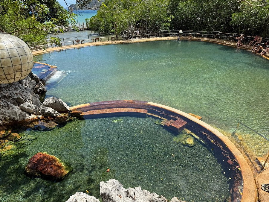
San Miguel Bay
San Miguel Bay, stretching between Camarines Norte and Camarines Sur, is a vast coastal expanse lined with mangroves and fishing villages, far from Luzon's typical tourist circuits.
San Miguel Bay opens onto the northern coast of the Bicol region in the Philippines, between the provinces of Camarines Norte and Camarines Sur. A vast shallow-water expanse bordered by mangroves and fishing villages, it is renowned for its exceptional fishing resources and pristine coastal landscapes. Far from Luzon's conventional tourist routes, it attracts primarily nature enthusiasts and travelers curious about Philippine maritime life.
What to see
The bay is framed by dense mangrove forests that serve as natural nurseries for fish and shrimp. Traditional fishing villages dot the shoreline, with their colorful bangka (outrigger canoes) pulled up on the beach. On clear days, the volcanic ridges of the Bicol hinterland rise against the horizon.
- Mangroves : coastal forests accessible by bangka, habitat for seabirds.
- Fishing villages : scenes of authentic life, nets drying in the sun, morning fish markets.
- Marine fauna : the bay is renowned for its populations of shrimp and coastal fish.
History and context
San Miguel Bay is one of Luzon's most productive fishing bays. Studies conducted since the 1980s by Philippine and international research organizations have documented the richness of its coastal ecosystems and the pressures exerted by intensive fishing. It is cited in scientific literature as a case study for marine resource management in Southeast Asia.
Photography tips
Morning light, before 8 a.m., is ideal for photographing fishermen returning to port and bangka on calm waters. Sunset offers golden reflections across the bay. From a boat, frame the mangroves from a low angle to emphasize their density.
Location and access
The bay is accessible from Daet, the capital of Camarines Norte, or from Naga, the main city of Camarines Sur. Daet has a bus terminal connected to Manila by long-distance buses (approximately 8 to 9 hours of travel). Tricycles and bangka allow you to reach coastal villages from Daet. There is no formalized tourist infrastructure on the bay; visits are generally arranged by contacting local fishermen directly or through a local agency in Naga.
Nearby attractions
- Mayon Volcano — the most perfect volcanic cone in the Philippines, visible from the Bicol region.
- Caramoan Peninsula — karst cliffs and secluded beaches, east of Camarines Sur.
- Daet — coastal city in Camarines Norte, a departure point for exploring the bay.
Frequently asked questions
The dry season, from November to May, offers more stable weather conditions. The Bicol region is exposed to typhoons between June and October.
Long-distance buses connect Manila to Daet. From Daet, tricycles and bangka allow you to reach the bay's coastal villages.
Accommodation options around the bay remain limited. Daet offers more varied hotel and guesthouse options to serve as a base.
Yes. The Caramoan Peninsula and Mayon Volcano are the region's most visited sites and easily integrate into a Bicol circuit.
San Miguel Bay is a shallow bay devoted to fishing, not well-known for diving. The region's renowned diving sites are found rather around Caramoan or Donsol.
Interested in this visit?
We can include it in your personalised itinerary.